 |
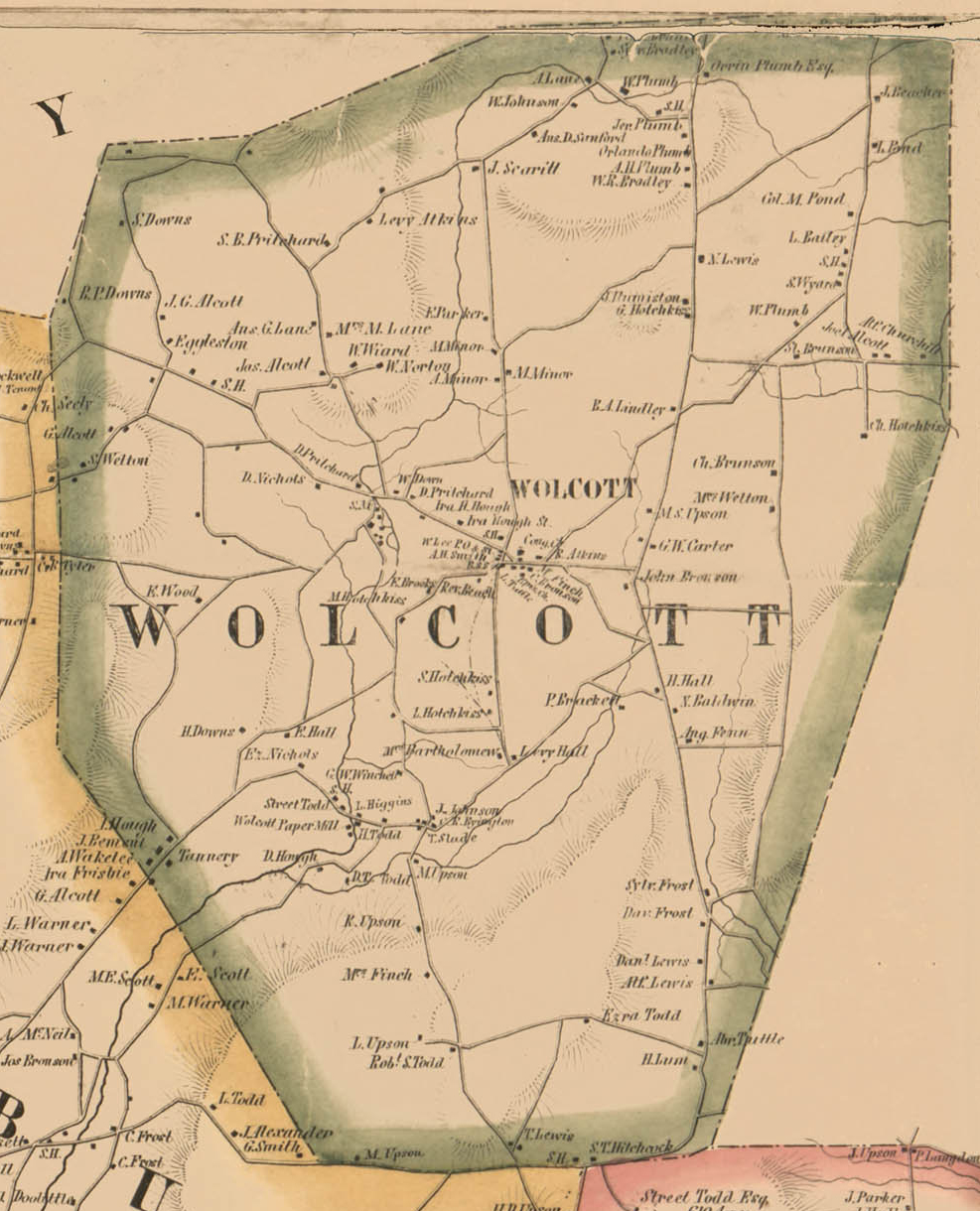
1856 |
An 1856 map of Wolcott. |
|
|
|
 |
1868 |
This map of Wolcott was produced shortly after the Civil War (monochrome version). |
|
|
|
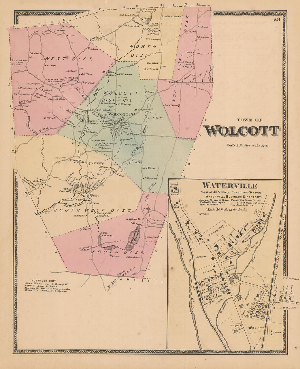 |
1868 |
This map of Wolcott was produced shortly after the Civil War (color version). |
|
|
|
 |
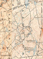
1893 |
This map combines two United States Geological Survey maps produced in 1893. |
|
|
|
 |
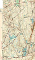
1904-1906 |
This map combines two United States Geological Survey maps, one produced in 1904 and the other produced in 1906. |
|
|
|
 |
1946 |
This map combines two United States Geological Survey maps produced in 1946. Two maps that cover the western portion of Wolcott were not available. |
|
|
|
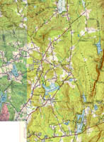 |
Mid-1950s |
This map combines four United States Geological Survey maps produced in 1953, 1955, and 1956. |
|
|
|
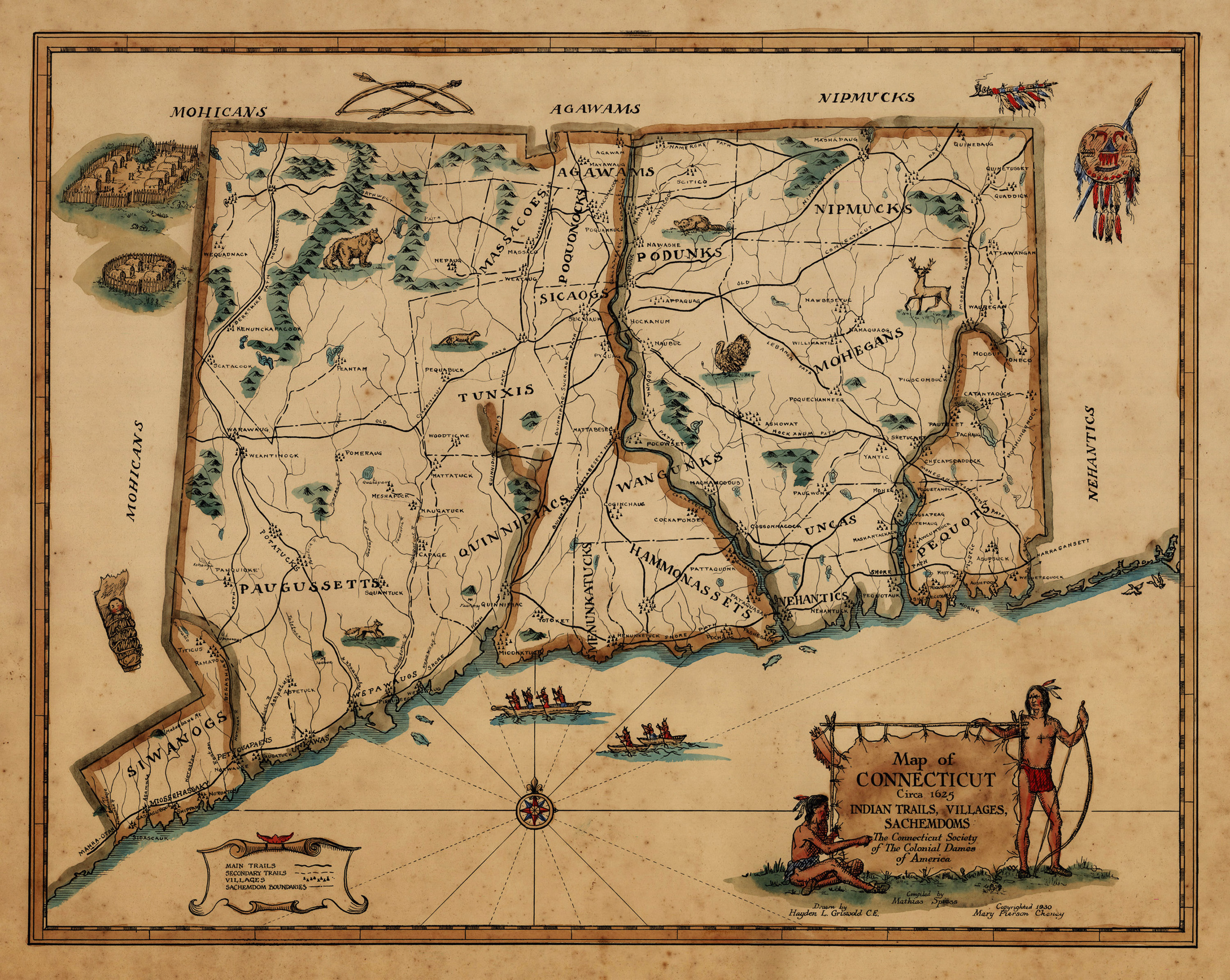 |
Native Americans |
This map of Connecticut Indian trails and settlements includes the Indian village of "Woodticke." |